This is the sequel to my last blog post, Dry Cabins, Futility, and General Darkness. It’s late, but that’s probably on-brand for me at this point. (How long does it take to establish a brand, anyway? How many years do I have to struggle to get things out on time before I’m just “that guy whose content is always late?”) Anyway, on to the uplifting content you’ve been waiting for!
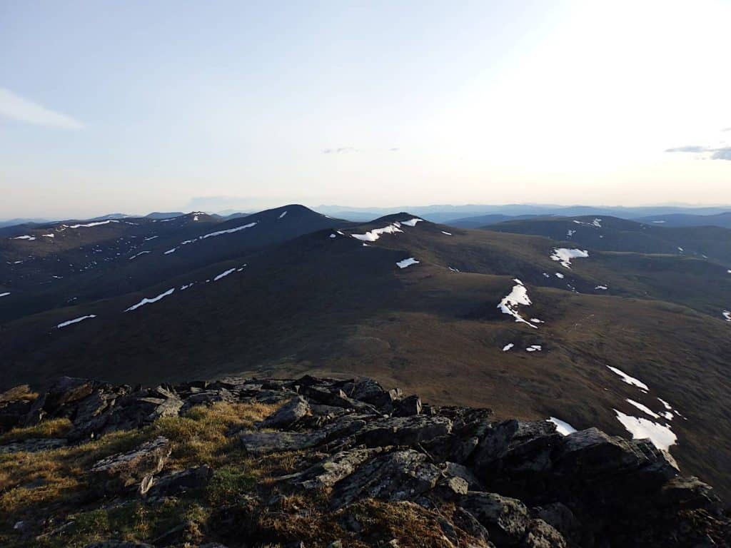
Porcupine Dome
In late June, just before the summer solstice, I hiked out to Porcupine Dome in the White Mountains.
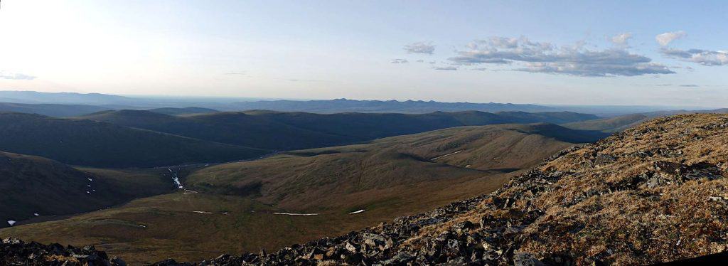
Porcupine Dome is about 6 miles in from the east end of the Pinnell Mountain Trail. Starting from the Eagle Summit wayside on the Steese Highway, the trail winds through wind-swept alpine tundra for roughly 27 miles, along a series of ridges and saddles in the White Mountains, to the 12 Mile Summit wayside. Although there’s a respectable amount of elevation gain and loss, the trail remains above the tree line pretty much its entire length.
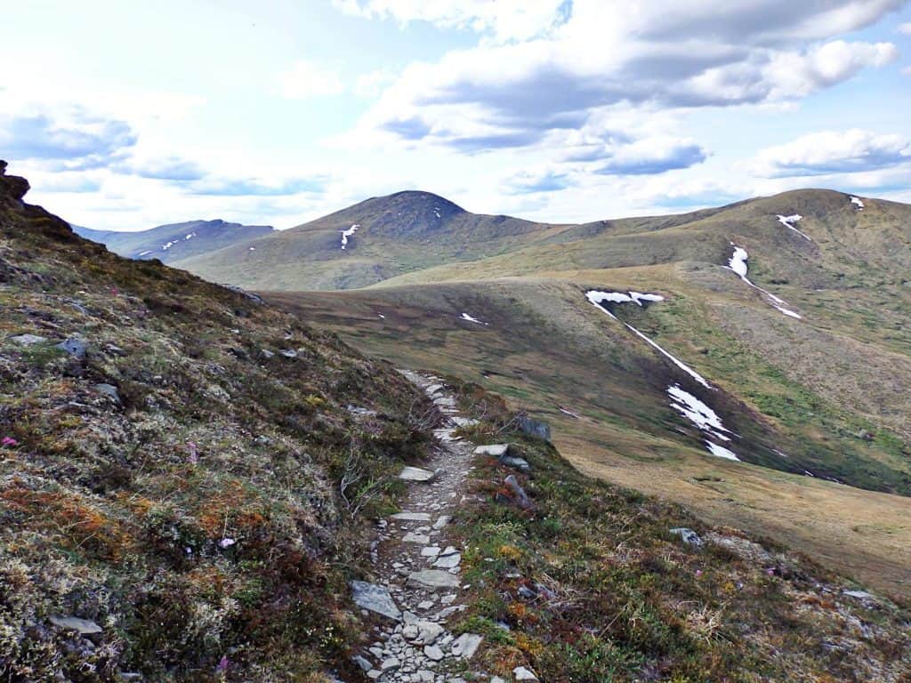
Spring comes late to places at that elevation this far north, and the landscape was still a little brown. There were patches of snow on the ground on north-facing slopes, some of which will persist through July and into August. It was in the 70s, reasonably dry, and mostly clear– although a faint haze of wildfire smoke became more pronounced as the day wore on.
The last time I hiked the Eagle Summit end of the trail was back in 2014. That also happens to have been the second time I climbed Porcupine Dome, and the first time I made it all the way out to Pinnell Mountain at mile 9.5 of the trail. From there I could look down on the first overnight trail shelter. (The Pinnell Mountain Trail is typically hiked from end to end over the course of three days, with two overnight shelters positioned accordingly.) By time I made it back to the Eagle Summit wayside, I’d covered approximately 19 miles. It was a long walk.
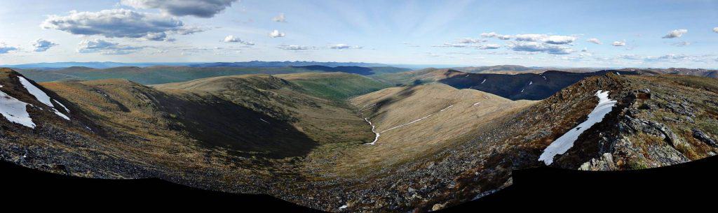
Even with enough food and water (something I neglected to bring back in 2014,) I have a better appreciation of my limits this time and settled on turning around after summiting Porcupine Dome.
The Dome is a hill so steep and so coated in unstable loose rock that it’s not hard to see how it got its prickly name. It has a formal elevation of 4944 feet, and its peak is home to a scattering of equipment. There’s an Alaska Fire Service relay, an earthquake monitor and its transmitter, and a larger comm tower belonging to (oddly enough) Eielson Air Force Base Range Control.
Green Lakes and Rivers
At lower elevations, especially around water, the landscape of Interior Alaska is far more green.
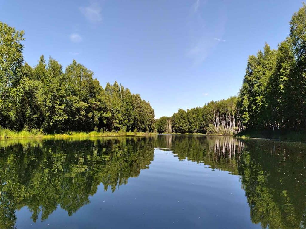
I haven’t spent a ton of time out on the water this summer, but it’s still a lot more than I managed the last few years. Probably the most notable kayaking adventure I’ve had so far involved a series of wide sloughs behind a popular local lake. Since few people find their way back there, the stocked fish are so thick that the depths are alive with movement.
Photography, Photo Editing, and New Blog Ideas
It took me quite a while to put this post together. Part of that time was spent learning some new photo editing techniques, including stitching panoramas together using a program called Hugin, and enhancing photos using some of the more complex filters available in GIMP. I’m really pleased with the results, and I feel that it was definitely time well spent.
I also discovered a WordPress plugin that will (hopefully) allow me to put these photos up on my blog in decent quality without causing the page to load slowly. The page size/page speed problem is honestly one of the reasons I’ve scaled back the inclusion of photos on my blog until now. I have my fingers crossed that I may have finally found a solution.
Now that I know what I can do, and what kind of photos I need to take to create really excellent panoramas, future photography posts should be even better than this one. Please let me know if you’ve enjoyed this post and would like to see more like it!